Poor field drainage is one of the main factors affecting yields Good hydro-agricultural installations will help you improve your fields’ yield potential, reduce compaction and avoid soil erosion. By using GPS technology for your field works, you’ll save time, fuel and respect the natural topography of your fields as much as possible. JLD-Laguë’s integrated solutions offer you products and services to simplify your drainage and levelling work.
Home / Technologies /
Water management
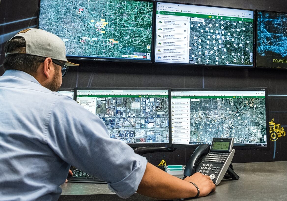
Telematics
Telematics includes the following technology:
- Equipment usage information
- Equipment health monitoring
- Equipment optimization
Levelling and drainage are essential in helping you improve your soil. Your tractor will alert you in case of problems so that you can intervene proactively to avoid downtime in the field and plan maintenance work.
In addition, when you choose to share this information with our support teams, we can help you optimize your tractor. We will also track equipment alerts so that action can be taken proactively to minimize downtime and plan maintenance during less critical periods.
Water Management Technology
Surface drainage (levelling): GCS – DIRT
Maximize your field leveling efficiency with GPS.
- GCS – Dirt I software: “From computer design to automatic control in the field.”
- Watch the explanatory video on surface drainage by GPS-RTK GCS.
- GCS-Dirt I uses all types of RTK GPS systems to provide you with accurate topography and levelling control.
- GCS-Dirt I’s virtual dashboard helps you work your fields easily using real-time information on cut/fill amounts, your position, elevation, slope, GPS quality, and the view of your field, knowing where to cut and fill while tracking your work.
- No more sections; work your field as a whole.
- Capture your data while you work.
- Recalculate your cut/fill balance in the field. GCS-Dirt I is compatible with most land grading design software, including OptiSurface Designer and GCS-Shape ProTM. GCS-DirtPro may be used in information mode only or in automatic control mode.
- Intuitive menus
- User-friendly

Underground drainage: GCS – PIPE I/ GCS – PIPE III
- GCS-Pipe’s proven technology has been used for over 15 years. The GCS-Pipe IIITM software automatically calculates the optimal drain placement based on the minimum and maximum depth as well as the minimum slope and makes it possible to control drain installation in real time.
- Efficient design: RTK GPS DGPS
- Vertical Curve Technology
- Profile view
- Bird’s-eye view with drain spacing
- Real-time depth and slope information
- Real-time profile adjustment
- Distance report
- Simple program navigation
- Export drawing of completed field
- If you hit an obstacle, GCS – Pipe automatically recalculates the design of the new depth and will notify you if you are outside of your defined parameters.

Levelling Plan Design Software: OptiSurface Designer
- Your time is precious during leveling operations! Improve your productivity with OptiSurface.
- Draw up GPS levelling plans for major systems, such as GCS and Trimble, with a single software package.
- Import topographies in GCS, Trimble, Shapefile, .txt, .csv format.
- Analyze surface drainage and runoff before and after levelling.
- Take advantage of numerous adjustable parameters in each section.
- Plan your field as a whole or by zone: no need to manage section junctions.
- Create balanced zones to minimize land displacement.
- Enjoy local and fast technical support by our team of experts.

Laisser nous faire la conception de votre plan de drainage de surface!
Decision-making support
Our decision-making support tools help you analyze your fields’ topography, identify problem areas and plan work in the field.
Operations and equipment optimization
To get the full return on your investment, you need to optimize your tractor’s performance. This means making sure your equipment is properly maintained and adjusted to field conditions.
Our tools help you analyze performance, schedule your maintenance, adjust equipment according to conditions and monitor performance and progress.
JLD-Laguë Xpert Service

The JLD-Laguë Xpert Service is our team of 6 specialists dedicated specifically to precision agriculture, tasked with supporting you and ensuring that your precision agriculture tools are used to their full potential.
Learn more about precision agriculture and our Xpert Service today by contacting our Call Centre 24/7 at 1-877-4470-2583.
Xpert Service Programs